Sample Drone Data
Below you will find sample drone data-sets and their corresponding download links. Data-sets will have their file type(s) noted with a different link to each set. Some data-sets will be zipped files; these will be noted.
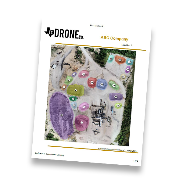
Stockpile Inventory Report
Sample Stockpile Inventory Report
Download the sample Stockpile Report by clicking below.
2D Illustrations


2D Orthomosaics (Maps)
Orthomosaics are like up-to-date detailed satellite maps. These can be viewed on their own or embedded in various types of software.
RGB (Real World Color)
Download GeoTiff (ArcGIS) ~56mb (*.tiff)
Download Map File (Google Earth) ~56mb (*.kml)
Elevation Heatmap
3d Illustrations

3d Models
Our drones are able to produce 3-dimensional point clouds through the wonderment of photogrammetry. These files can be used for a myriad of purposes including; 3d Modeling, AutoCad Drawings, Densified Point Clouds, VR Applications, 3d Textured Mesh, Grid DSM, or Digital Modeling.
Download Densified Point Cloud ~800mb (*.las)